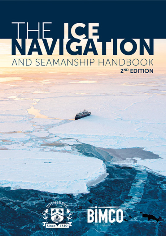
The handbook is a comprehensive guide to best practice for the safe navigation and operation of ships in ice. Now in its second edition, the guide has been fully updated to provide seafarers with both a practical and conceptual understanding of this challenging environment. Topics covered include an overview of ice regions (including ice types, seasonal challenges and safe routeing practices), preparing a ship and its crew for ice (including crew training) and regulatory guidance (including pollution response and the Polar Code).
Cited as a recommended training resource for ice navigation procedures in OCIMF’s SIRE 2.0 questionnaire.
This revised second edition is the definitive guide for ships operating in ice. Fully updated, with input from leading industry experts and passenger and research ship Masters, it outlines both the geography and characteristics of ice and provides practical guidance for the ship and its crew.
The book is divided into three main sections.
Part One covers ice types and regions, including detailed maps, information on seasonal trends and major routes and ice ports.
Part Two outlines regulations and guidance. It includes:
- Guidance on preparing a ship for ice, including operational considerations such as ballast water management
- guidance on preparing a crew for ice, including training, requirements for appropriate clothing and PPE (all in adherence with the STCW Convention and associated STCW Code)
- regional and international regulations and regulatory guidance, including the Polar Code, ballast water regulations, biofouling, underwater radiated noise and SOLAS and MARPOL
- information on ice class ships, including icebreakers and mooring equipment
- forecasting information, including updated satellite imagery, ice forecasts and ice charts and international and SOLAS requirements for ice reporting.
Part Three covers practical considerations, including:
- Updated guidance on navigation, passage planning and watchkeeping (including new charts, imagery and radar/POLARIS)
- ship handling and ship operations
- working with ice breakers
- pollution prevention and response.
The guide also includes practical checklists for both the deck and engine departments.
This publication replaces the following withdrawn and out-of-date publications:
'The BIMCO Ice Handbook' published in 2005 by The Baltic and International Maritime Council
(BIMCO)
'The Ice Navigation Manual' published in 2010 by Witherby Seamanship International Ltd.
Navigation in ice is one of the most challenging tasks a mariner may face. The navigator is concerned with the physical dangers of the ice and the restrictions imposed on the ship, in terms of route, speed and endurance. The need to protect those on board, whether from the risk of collision with an iceberg or more generally from exposure to hazardous climatic conditions, must be ever present in the mind of the navigator.
The harsh realities of icy environments are equally challenging to the mariner. Keeping a proper lookout and maintaining a safe route through different types of ice are difficult in areas such as the polar regions, where aids to navigation are minimal and where electronic equipment is affected by the environment.
The changing nature of the environment, due to global warming and the subsequent melting of the icecaps, has resulted in considerable growth in maritime traffic in the polar regions. New shipping routes have opened up and there has been increased interest in the extraction of raw materials.
The Polar Code entered into force on 1st January 2017 in recognition of the need for regulatory protection of these vulnerable sea areas. It is designed to protect the environment from shipping, and equally to protect those on board ships that venture to the harsh polar regions.
The SOLAS, STCW and MARPOL conventions continue to directly apply to ships and navigators operating in ice, setting out the minimum requirements for ship design, safety, manning and environmental protection.
As with all navigation, careful preparation significantly reduces the risk of an accident. In icy environments, consideration should be given to the nature of the ice, its dangers and the regions where it is encountered, ship handling, passage planning, crew training, and preparing the ship for the expected weather. This manual will allow seafarers to acquire the necessary knowledge and understanding which, when combined with practical experience, will enable safe navigation in ice.
Introduction xi
Acknowledgements xiii
Part 1
Chapter 1 - Ice Types
1 Ice Types
1.1 Fresh Water Ice
1.2 Sea Ice
1.3 Glacial Ice
1.4 Fast Ice
1.5 Pack Ice
1.6 Ice Movement (Drift)
1.7 Ice Deterioration and Change
Chapter 2 - Ice Region Overviews
2.1 The Ice Regions
2.2 Northern Ice
2.3 Southern Ice
Chapter 3 - Northern Ice: European/Russian Ice
3.1 The Baltic Sea
3.2 The Black Sea
3.2.1 Sea of Azov
3.3 The Barents Sea
3.3.1 Norwegian Sector
3.3.2 Russian Sector and the White Sea
3.4 The Northern Sea Route (NSR) (The Northeast Passage)
3.5 The Chukchi Sea
Chapter 4 ? Northern Ice: Asian Ice
4.1 The Sea of Japan, Sakhalin Island and the Sea of Okhotsk
4.1.1 Strait of Tartary
4.1.2 La Pérouse Strait and Nemuro Strait
4.2 The Bohai and Yellow Seas
Chapter 5 ? Northern Ice: North American Ice
5.1 Bering Strait
5.2 Southern Alaska
5.2.1 Cook Inlet
5.2.2 Prince William Sound
5.3 The Beaufort Sea
5.4 The Northwest Passage
5.4.1 Notable Transits of the Northwest Passage
5.4.2 Queen Elizabeth Islands ? McClure Straits to Lancaster Sound
5.4.3 Lancaster Sound
5.4.4 Hudson Bay
5.5 Newfoundland, the Great Lakes and the Saint Lawrence Seaway
5.5.1 Great Lakes Ice Types
5.6 The North Atlantic Ocean
5.6.1 US East Coast
5.7 Greenland
Chapter 6 ? Southern Ice
6.1 The South Atlantic Ocean
6.1.1 South Georgia and the South Sandwich Islands
6.1.2 The Drake Passage and Scotia Sea
6.2 The Antarctic Ocean (Antarctica)
6.2.1 The Ross Sea
6.2.2 The Antarctic Peninsula
6.2.2.1 The South Shetland Islands
6.2.2.2 The Weddell Sea
Part 2
Chapter 7 ? Regulations and the Polar Code
7 Regulations
7.1 Overview of International Regulations
7.2 MARPOL Convention
7.3 Ballast Water
7.4 Biofouling
7.5 Underwater Radiated Noise
7.6 SOLAS Convention
7.7 The Polar Code
7.8 Regional and Local Regulations
7.8.1 Baltic States
7.8.2 Norway and Svalbard
7.8.3 Greenland
7.8.4 Canada
7.8.5 United States
7.8.6 Russia
7.8.7 Southern Ice Areas
7.9 Sovereignty
Chapter 8 ? Ice Class Ships
8 Ice Class Ships
8.1 Classification Standards
8.2 Ice Design Considerations
8.3 Class Notations for Winterisation and De-Icing
8.4 Double-Acting Ships
8.5 Icebreaking Propulsion Plant
8.6 Mooring Equipment
8.7 Insurance and Damage
8.8 Icebreaker Construction
Chapter 9 ? Preparing the Crew for Ice
9 Preparing the Crew for Ice
9.1 STCW Training and Certification
9.2 General Training Considerations
9.3 Clothing
9.4 Accidents and Emergencies
9.5 General Crew Comfort
9.6 Wind Chill
9.7 Medical
9.8 Drills and onboard Training
Chapter 10 ? Preparing a Ship for Ice
10 Preparing a Ship for Ice
10.1 Ballast and Trim
10.2 Fresh Water Tanks and Fire Lines
10.3 Main Engine and Machinery
10.4 Sea Inlets
10.5 Garbage and Waste
10.6 Searchlights
10.7 Deck and Machinery Protection
10.8 Cold Soaking and Condensation
10.9 Ice Accretion and Stability
10.10 De-Icing
10.11 Safety Considerations
10.12 Checklist for the Deck Department
10.13 Checklist for the Engine Department
Chapter 11 ? Forecasting and Reporting Ice Conditions
11.1 International and SOLAS Requirements for Ice Reporting
11.2 Ice Forecasts and Ice Charts
11.3 The Egg Code
11.4 Colour Coding Ice Charts
11.5 Ice Symbols and Indications Associated with International Ice Charts
11.6 Iceberg Coding and Message Preparation
11.7 Ice Reporting and Forecast Systems in the Baltic Sea
11.8 Ice Reporting and Forecast Systems in the Arctic Region
11.9 Ice Reporting and Forecast Systems in the Antarctic Region
11.10 Use of Satellite Imagery for Onboard Navigation
11.11 Private Sources of Information/Satellite Data
Part 3
Chapter 12 ? Navigation in Ice
12 Navigation in Ice
12.1 Passage Planning
12.2 Watchkeeping Practices
12.3 Evidence of Ice
12.4 Navigation in Pack Ice
12.5 Navigating in the Vicinity of Icebergs
12.6 Visibility and Heating
12.7 Position Fixing in Ice Conditions
12.8 Radar Use in Ice Conditions
12.9 Compasses
Chapter 13 ? Ship Handling
13 Ship Handling
13.1 Entering the Ice
13.2 Approaching the Ice Edge
13.3 Underway in Ice
13.4 Pinch Points
13.5 Beset in Ice
13.6 Anchoring in Ice
13.7 Inland Navigation: Canal and Lock Systems
13.8 Damage in Ice
13.9 Berthing in Ports with Ice
Chapter 14 ? Ship Operations in Ice
14 Ship Operations in Ice
14.1 Cargo Operations (Oil/Gas/Chemical)
14.2 Cargo Operations (Bulk/General)
14.3 Passenger Ships
14.4 Research Ships
14.5 Managing Ballast Water in Low Temperatures
14.6 Port State Control Inspections
14.7 Additional Problems Alongside in Ice
Chapter 15 ? Working with Icebreakers
15 Working with Icebreakers
15.1 Icebreaker Assistance for Beset Ships
15.2 Ice Convoys
15.3 Requirements for Escorted Ships
15.4 Towing in Ice
15.5 Nuclear-powered Icebreakers
15.6 The World Icebreaker and Icebreaking Supply Fleet
Chapter 16 ? Pollution in Ice-Covered Waters
16 Pollution in Ice-Covered Waters
16.1 Introduction and Overview
16.2 Incidents and Accidents in Ice-Covered Waters
16.3 Spill Scenarios
16.4 Oil Fate and Behaviour
16.5 Detection and Spill Surveillance
16.6 Response Strategies ? Recovery and Removal
16.7 International Agreements, Liabilities and Regulations
16.8 Regional Spill Response Resources
16.9 Response Planning Resources
Glossary
Annex I ? International Navigating Limits (INL)
Annex II ? Ice Breaking Services in the Baltic
Index
BIMCO
BIMCO is the world's largest direct-membership organisation for shipowners, charterers, shipbrokers and agents. In total, around 60% of the world?s merchant fleet is a BIMCO member, measured by tonnage (weight of the unloaded ships).
The organisation has NGO status and is based in Copenhagen, Denmark, with offices in Athens, Singapore and Shanghai.
With around 1900 member companies across 120 countries, from the largest shipowners in the world to small local port agents and law firms, BIMCO represents a wide range of maritime companies and organisations.
BIMCO's goal is to secure a level playing field for the global shipping industry. BIMCO therefore works to promote and secure global standards and regulations for the maritime sector. The organisation?s century long effort into creating standard contracts and clauses is an expression of that aim.
Witherbys
Witherbys titles are developed using scripts developed by technical experts that are peer reviewed within work groups. Typically, they seek to improve understanding of the regulations, recommendations and guidelines issued by Industry.
Witherbys staff have significant expertise in the fields of navigation and hazardous cargoes as well as in the presentation of complex subjects in a graphic and easy to understand manner.
- Number of Pages:
- 486
- Book Height:
- 310 mm
- Book Width:
- 220 mm
- Publication Date:
- August 2024
- Author:
Witherbys and BIMCO
- Weight:
- 2.3 kg
- Published Date:
- August 2024
- Preview:
- Yes


