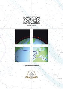
Ship Navigation demonstrates the art and science of navigating a ship from departure to destination without hitting the shore or shoals. There are essential decisions which need to be made every day in navigational work and the book provides guidance on how to make the right choices.
Ship Navigation does not require any prior knowledge of the subject from the reader. It starts at the beginning: the first chapter is devoted to definitions and an overview of the challenges facing the navigator and ways of solving them.
Both traditional and modern methods of navigation are discussed. An analysis of investigations into recent incidents of vessels running aground or colliding indicates that there is still a demand for ‘traditional’ methods.
The text deals with navigational problems and methods from a practical viewpoint and contains many pictures and step-by-step diagrams. This makes it easy for the reader to understand not only the theoretical aspects of the problem at hand, but also the situation when actually on watch.
In spite of – or perhaps because of – the abundance of sophisticated electronic navigational aids available today, the human factor is still recognised as a major obstacle to safe navigation. The author has provided numerous examples from accident reports and investigations which illustrate how this unpredictable element impacts on watch keepers and their ability to navigate safely at all times.
The excellent text written by a Master Mariner with many years of watch keeping experience on the high seas and coastal waters, combined with the excellent colour and black-and-white illustrations makes this an essential source of reference for every student of marine science. It will also be useful to many practising deck officers who want to keep up-to-date with the theory and practice of their profession.
Foreword
Chapter 1 Introduction
Chapter 2 Nautical information and aids to navigation
Chapter 3 Electronic charts
Chapter 4 Navigational instruments
Chapter 5 Navigation system
Chapter 6 The course
Chapter 7 Finding the position
Chapter 8 Route planning
Chapter 9 Route planning with electronic charts
Chapter 10 Route executing and monitoring
Chapter 11 Steering
Chapter 12 Safer navigation
Chapter 13 Tides
Chapter 14 The sailings
Index
- Number of Pages:
- 404
- Book Height:
- 297 mm
- Book Width:
- 210 mm
- Author:
Bjorge Wallin
- Published Date:
- October 2022
- Preview:
- Yes
- Publication Date:
- October 2022


