Posted by Witherbys on 9th Aug 2023
6 Things You Should Know about Passage Planning in the Great Barrier Reef and Torres Strait
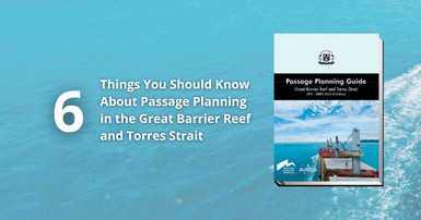
The Great Barrier Reef and Torres Strait is an area of significant global environmental and economic importance. Planning a passage through this area can be a challenging prospect, especially if the bridge team is unfamiliar with the region. This means that accurate, well-presented and up-to-date passage planning guidance is of great importance for any crew navigating the region. Using the expertise of Witherbys staff and the new edition of Passage Planning Guide: Great Barrier Reef and Torres Strait (PPG – GBRTS) – 2023–24 Edition as references we have come up with six things we think you should know about passage planning in the Great Barrier Reef and Torres Strait:
- The Great Barrier Reef is the largest coral reef system in the world, composed of almost 3,000 individual reefs and 900 islands that extend more than 1,600 miles. Only about 50% of all the reefs have been properly surveyed.
- Although the whole of the Torres Strait and Great Barrier Reef lies within the state of Queensland, regulation of all activities within the Marine Park is covered by the Great Barrier Reef Marine Park Act and administered jointly by the Australian Maritime Safety Authority (AMSA), Queensland Park and Wildlife Service, Maritime Safety Queensland (MSQ) and the Great Barrier Reef Marine Park Authority (GBRMPA).
- The Torres Strait is the meeting point of the Indian and Pacific Oceans, and this combined with the many reefs, coral cays and continental islands makes it one of the most complex tidal systems in the world. At certain times of the month simultaneous high and low water can be experienced at points only a few miles apart. Consequently, strong, rapidly changing tidal streams and wind generated currents are to be expected.
- Many maritime authorities consider over-reliance on GNSS positioning and ECDIS to be the greatest danger in their use. The Great Barrier Reef provides many opportunities for the Bridge Team to cross-check satellite-based positions using such methods as parallel indexing, visual and radar fixing methods. Detailed photographs of the Aids to Navigation (AtoNs) are provided in Passage Planning Guide: Great Barrier Reef and Torres Strait (PPG – GBRTS) – 2023–24 Edition, to assist with safer navigation.
- Prior to entering the GBRTS, it is good practice to convene a meeting for all essential personnel to discuss navigational safety and engine room requirements. During this meeting, watchkeepers and crew will be made aware of their duties on the bridge, on deck and in the engine room. This establishes the requisite team dynamic and understanding of the upcoming passage and therefore the importance of this cannot be overemphasised. A pull-out bridge team briefing card, produced in conjunction with Auriga Pilots, is provided with the 2023–24 edition of Passage Planning Guide: Great Barrier Reef and Torres Strait (PPG – GBRTS).
- The Great Barrier Reef is a UNESCO World Heritage Site. Permissible uses of the Marine Park, including passage by large commercial vessels, are controlled by a complex series of overlapping areas which can be difficult to visualise. However, while this complexity is unavoidable on paper charts, selective use of information layers in the ENC can optimise the ECDIS display to show only what is necessary for a particular voyage or segment. Passage Planning Guide: Great Barrier Reef and Torres Strait (PPG – GBRTS) – 2023–24 Edition now includes improved diagrams showing marine park boundaries and MARPOL limits in the region.
You can learn more about passage planning in the Great Barrier Reef and Torres Strait and purchase the guide here. Witherbys is dedicated to bringing the most up-to-date and accessible advice on passage planning in a wide range of regions. Browse all of Witherbys’ passage planning publications here. For more information visit Auriga, Great Barrier Reef Marine Park Authority, Australian Maritime Safety Authority and Maritime Industry Australia.

